
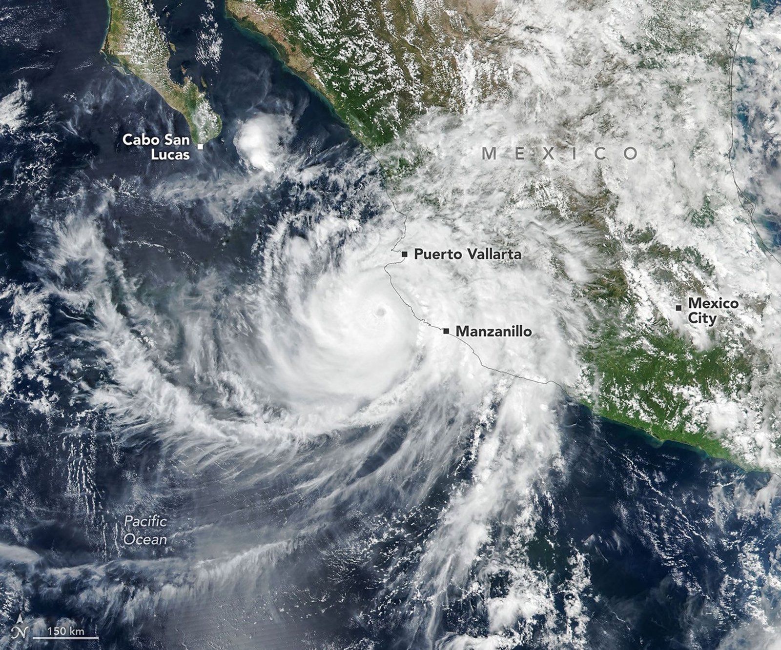
Hurricane Simon moved near the Mexican coast as a strong category 4 storm. Meteorologists continue to track the unpredictable path of the system.
Hurricane Simon recently traveled along the coast of Mexico. It reached category 4 status on October 11, 2026. The storm packed sustained winds of 155 miles per hour.
Also, the storm moved in a north-northwest direction. Its eye stayed about 30 miles off the shore. The storm sat between the cities of Manzanillo and Puerto Vallarta.
Next, satellites captured clear images of the system. The National Hurricane Center reported winds near 130 miles per hour. The storm's core brushed against the local coastline.
However, the Sierra Madre mountains helped weaken the system. The terrain forced the wind field to shrink. Still, the hurricane brought heavy rain to the region.
As a result, officials warned of flooding in Manzanillo. They also tracked a high risk of mudslides in the mountains. The storm posed a serious threat to those areas.
Then, scientists studied the storm using satellite data. They observed gravity waves radiating from the hurricane's center. These ripples form when intense heat releases into the atmosphere.
Later, the NOAA-21 satellite recorded these waves at night. The system showed ripples in the upper atmosphere. Low moonlight helped these light patterns stand out clearly.
Now, meteorologists struggle to predict the path of the storm. Forecasts for the system remain highly uncertain. Experts cannot say for sure where it will land.
Finally, the storm may enter the Gulf of California. Large ocean swells threaten the southwestern coast of Mexico. Residents face dangerous conditions near the shore as the storm evolves.