
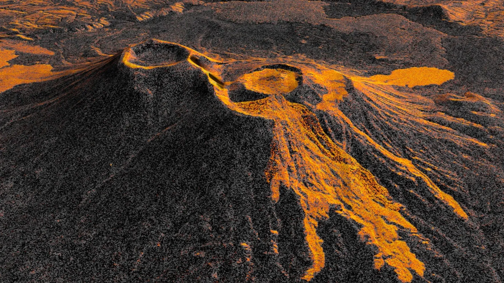
NASA's NISAR mission provides new insights into volcanic activity in Russia, while maritime security concerns intensify following a fatal attack on an Indian cargo ship.
The successful deployment and operational stabilization of the NASA-ISRO Synthetic Aperture Radar (NISAR) satellite have provided unprecedented clarity into the behavior of the Krasheninnikov volcano in Russia’s Kamchatka Peninsula. As the satellite reaches full operational capacity, it has produced a high-resolution time-lapse sequence documenting the first volcanic activity at this site in nearly 500 years. This technical achievement arrives at a moment when global attention is increasingly fractured between environmental monitoring of remote natural disasters and escalating geopolitical instability across South Asia and the Middle East.
While NISAR’s radar-based imaging offers a new standard for tracking planetary hazards, the broader global landscape remains defined ent involving the Indian cargo vessel MV Cape Dao off the coast of Oman, further complicating regional stability. These parallel developments highlight a world where scientific advancements in space-based observation are running concurrently with terrestrial conflicts that demand immediate and often volatile diplomatic and security responses.
The ability to monitor a previously dormant volcano like Krasheninnikov with such precise, repetitive frequency represents a shift in how humanity manages geological risk. Historically, many of Kamchatka’s volcanoes remained largely unobserved due to their remote locations and the prohibitive costs of ground-based monitoring. NISAR changes this calculus before a hazard escalates into a regional catastrophe. This is not merely an academic exercise; it is a critical advancement for global infrastructure protection.
However, the value of this technological progress is tempered nternational cooperation, their utility is limited. The intersection of satellite monitoring and maritime security crises suggests that the international community is currently struggling to maintain focus on shared threats while simultaneously managing localized, high-intensity conflicts. The precedent set ies on a level of regional stability that is currently being tested
The NISAR mission utilizes advanced synthetic aperture radar (SAR) to penetrate cloud cover and darkness, providing a constant stream of data regardless of environmental conditions. gnals, the satellite creates a composite image that acts as a precise snapshot of terrestrial changes. This process, which sharpens imagery through the combination of multiple orbital passes, has allowed researchers to visualize the movement of molten rock as it fills the Krasheninnikov crater and expands into a fan-like formation.
Geophysicists analyzing the data have noted that the consistency of the mission’s 12-day orbital cycle is its most significant asset. imensional understanding of volcanic deformation. This capability is expected to be vital for future disaster mitigation, particularly as researchers look to apply these techniques to other high-risk, under-monitored volcanic regions across the globe.
While the scientific community celebrates the success of the NISAR program, maritime security officials are addressing the aftermath of the attack on the MV Cape Dao. The vessel, which was en route to India, sustained significant damage after being struck rmed fatality, marking a sharp increase in the risks faced
This attack occurs against a backdrop of broader diplomatic tensions. International forums, such as the United Nations General Assembly, have been marked onal security. While technological tools like NISAR offer a window into the physical changes of the earth, the human element of security remains dangerously unpredictable.
In the coming months, the scientific data harvested from the Krasheninnikov eruption will likely serve as a benchmark for satellite-based hazard modeling. Researchers expect to refine the SAR processing techniques used for this eruption to improve the speed at which disaster warnings can be issued for similar, remote geological sites. The success of this mission suggests that NASA and ISRO will prioritize continued, long-term monitoring of the Kamchatka region to ensure public safety in areas that were previously considered "blind spots" for geological instrumentation.
Simultaneously, the geopolitical outlook remains strained. Security analysts anticipate increased scrutiny of maritime transit lanes near Oman and the broader Indian Ocean region. The combination of targeted attacks on commercial shipping and ongoing diplomatic fractures at the United Nations suggests that international efforts to stabilize trade routes will likely involve increased naval oversight and intelligence sharing, even as global powers remain divided on wider strategic priorities.