

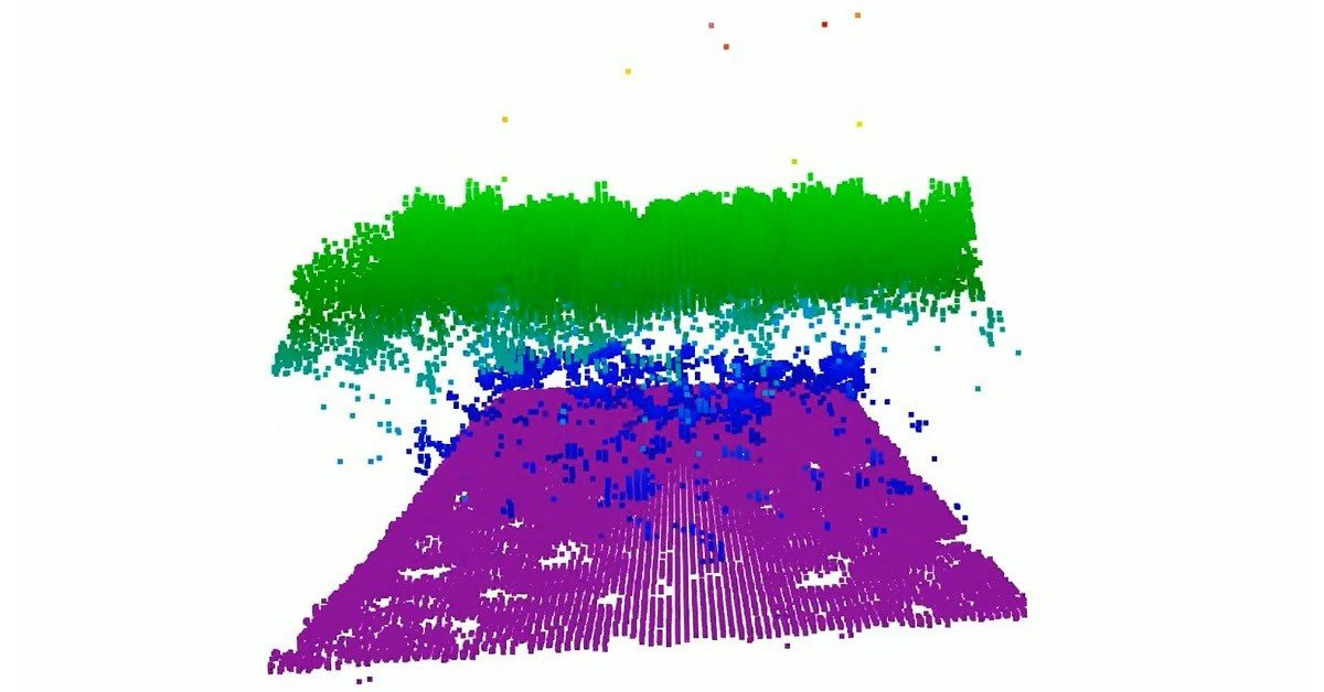
NASA’s new CASALS instrument uses advanced lidar technology to create continuous 3D maps of Earth, filling critical gaps in current surface data.
Current space instruments measure Earth's terrain in thin, narrow lines. These methods leave massive gaps between data points. NASA researchers created a new tool to solve this problem. The system is called CASALS.
Next, this technology combines machine learning with a compact lidar system. It allows scientists to scan wide areas of the ground. It creates detailed 3D maps of forests and land surfaces.
Also, the design removes the need for heavy, moving mirrors. It steers laser pulses using wavelength changes instead. This approach avoids mechanical failures in the harsh environment of space.
Then, the system uses a special laser that cycles through many unique wavelengths. These pulses pass through a patterned transmission grating. This process naturally steers the light into different positions.
As a result, the instrument paints a continuous 3D view of the ground. It eliminates the large gaps found in older lidar tools. The design also lowers the weight and power requirements.
Furthermore, the detector array features very high efficiency. It converts incoming light into electrical signals with 80% effectiveness. This allows the sensor to read signals from dark surfaces or thick forests.
Meanwhile, the team tested a prototype on a NASA aircraft in late 2024. The test flight produced high-quality data. It even captured details like individual tree branches from five kilometers high.
Finally, researchers plan to improve the technology for future space missions. They aim to widen the scanning area and add new software. They hope to launch a space-ready version in the coming years.
This mission will give scientists a better view of our changing planet. It represents a major step forward for remote sensing. The team continues to work toward this goal with funding support.