NASA’s Curiosity rover has entered a new phase of exploration in the “Valle Grande” region, analyzing banded terrain after hitting key mission milestones.
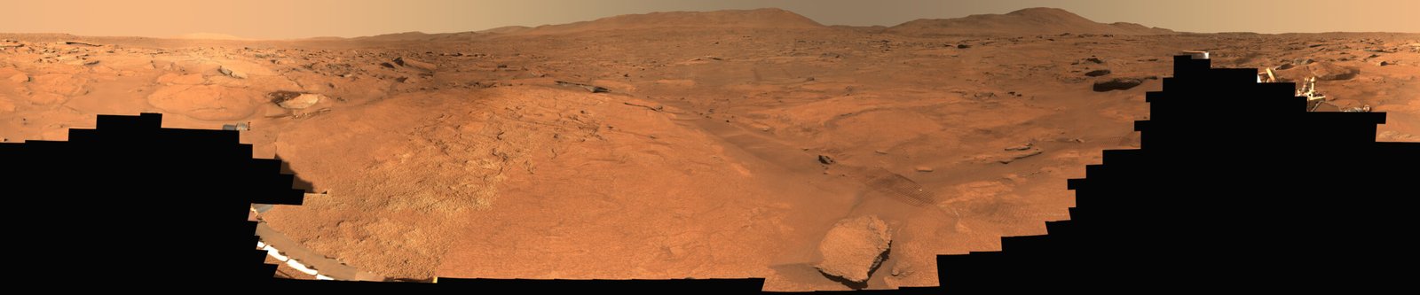
NASA’s Curiosity rover has entered a new phase of its exploration mission on Mars, navigating through a distinct, banded landscape within the area informally designated as “Valle Grande.” This traversal follows a series of significant operational achievements for the Mars Science Laboratory mission, which recently surpassed both its 5,000-sol milestone and an elevation gain of more than one kilometer.
As the rover pushes forward, mission scientists are utilizing high-resolution imaging and contact science instruments to analyze the geological variation of the region. The terrain, characterized pportunity to study shifting Martian environmental history, as these bands vary in scale from 25 to 200 meters in diameter. onal processes that shaped this sector of the planet.
The transition into the banded terrain of Valle Grande represents more than just a change in scenery; it highlights the rover's continued viability long after its primary mission objectives were achieved. al gap indicating a break in the rock record—Curiosity is effectively performing forensic science on a planetary scale. The ability to identify and analyze these specific contacts between different geological layers allows scientists to reconstruct environmental conditions from billions of years ago. As the mission moves past its 5,000-day threshold, the focus shifts from primary discovery to high-precision analysis of complex, nuanced geological transitions that were previously inaccessible, setting a precedent for how aging robotic assets can still yield critical data decades into their operational lives.
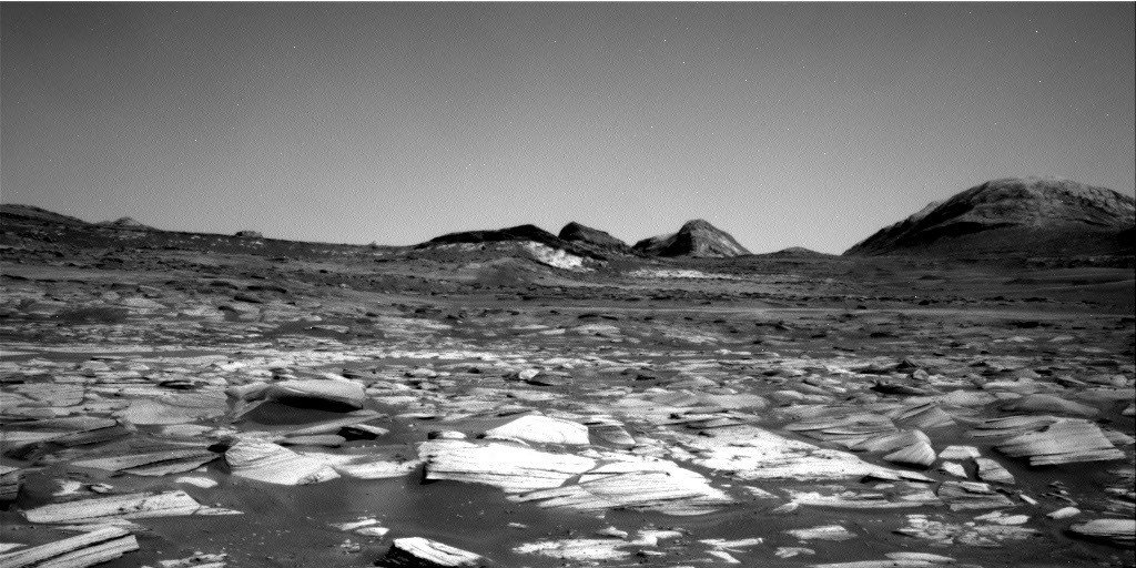
During the most recent planning cycle, the team focused on identifying targets within the coarse, pebbly sand that dominates the current path. On Sol 5014, the rover’s Right Navigation Camera successfully captured imagery showing the path ahead, highlighting the subtle tonal differences that define the local geology. These images are instrumental for mission planners in deciding where to position the rover for the next phase of contact science.
The scientific team utilized a variety of onboard instruments, including the Alpha Particle X-Ray Spectrometer (APXS) and the Mars Hand Lens Imager (MAHLI), to investigate nodular bedrock at sites named “Cerro Armazones” and “Monte Melimoyu.” Meanwhile, the ChemCam instrument performed Laser Induced Breakdown Spectroscopy (LIBS) on dark-toned nodules and float rocks. Following a drive of approximately 60 meters, the team identified a particularly promising, rough-textured outcrop, dubbed “Chiu Chiu,” which contains laminated areas and distinct chips that will serve as the primary focus for forthcoming contact science and laser analysis.
As the mission enters the latter half of 2026, the team is expected to maintain a steady, routine pace of exploration. With the 15th anniversary of the rover’s launch approaching on November 26, the current operational tempo suggests a transition toward sustained, long-term scientific investigation rather than rapid transit. Analysts anticipate that the rover will continue to utilize its long-distance imaging capabilities to scout for future contact science targets, balancing the need for mobility with the desire to extract maximum chemical data from the diverse outcrops encountered in the banded region. Future operations will likely rely on the data collected from the current “Chiu Chiu” block to refine models of the local stratigraphy as the rover pushes deeper into the valley.