

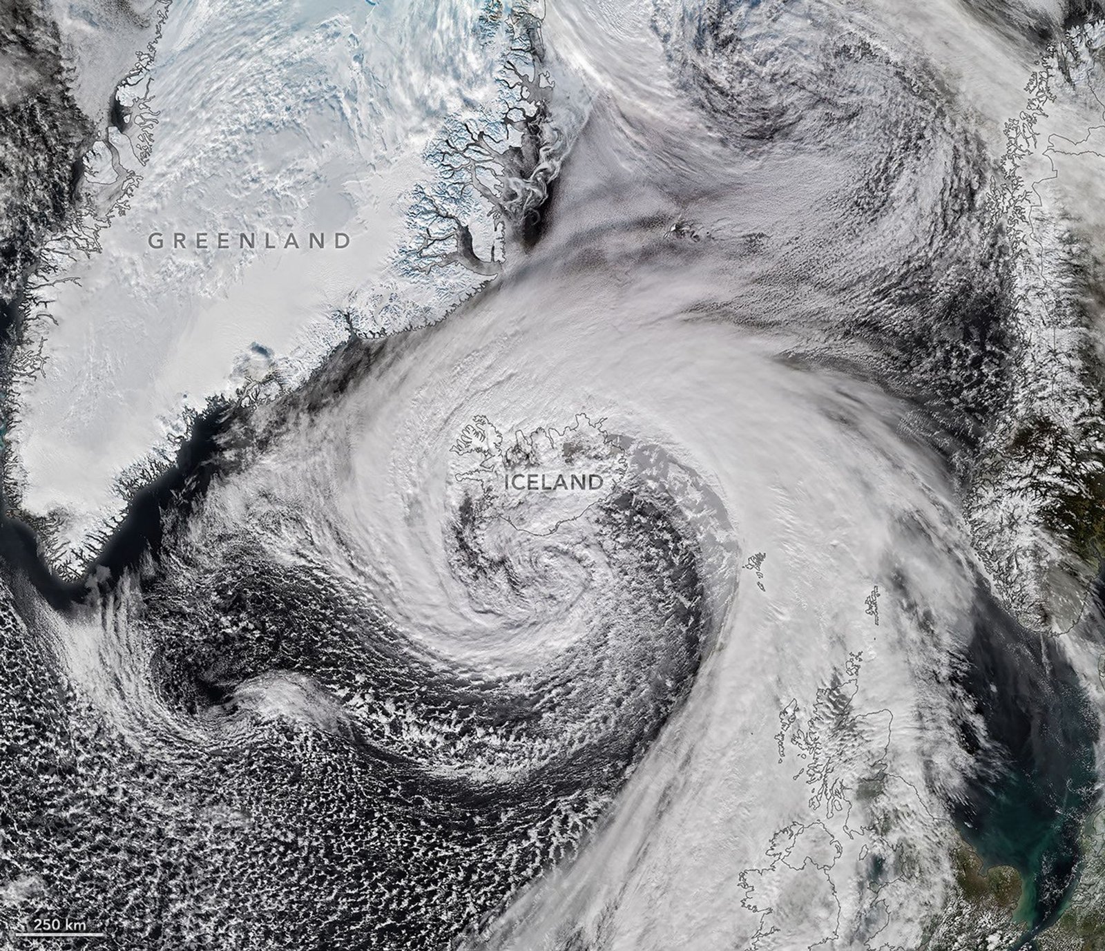
A powerful extratropical cyclone moved past Iceland after forming from the remnants of Hurricane Isaias.
Hurricane Isaias hit Florida as a Category 2 storm on October 9. It brought strong winds and heavy rain to the Gulf Coast. The storm then moved across the Eastern Seaboard.
Later, the system traveled east over the North Atlantic. It transformed into a strong extratropical cyclone. These storms often form comma-shaped cloud patterns.
Also, this weather system caused dangerous conditions. It brought heavy rain and hurricane-force winds. Some areas even faced blizzard-like weather.
Next, the NOAA-21 satellite captured images of the storm. The VIIRS instrument recorded the system near Iceland on October 14. This occurred during the afternoon hours.
Meanwhile, the air pressure dropped very quickly. It fell by 50 hectopascals in one day. Experts call this process bombogenesis.
Furthermore, the storm likely broke a long-standing record. It may have reached the lowest October barometric pressure in Iceland. The previous record stood since 1963.
As a result, high winds lashed the Icelandic coast. A sensor near a volcano recorded gusts of 205 kilometers per hour. A small island saw sustained winds of 150 kilometers per hour.
Still, the damage stretched to northern regions. Residents prepared for sleet and snow. The storm proved very intense for the local area.
Finally, the winds reached northwestern Scotland. Gusts hit 90 kilometers per hour on October 14. This weather forced several ferry companies to cancel their routes.